16 Feb 2022 App Of The Day
GPS Map Camera: Geotag Photos & Add GPS Location
by GPS Map Camera
Description
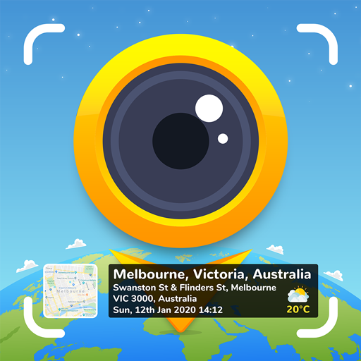
Whether It’s your travel memories or your Visit to a particular place, with GPS Map camera stamp application, add Datetime, Map, Latitude, Longitude, Altitude, Weather, Magnetic field, Compass to Your Camera Photos.
Track Live location along with your captured Photos by GPS Map Camera: Geotag Photos & Add GPS Location Application. Send your Geo Location of Street / Place added photos to your Family & Friends, and let them know about your best Earth travel memories.
How to add GPS map location on photos?
✔ Install GPS Map Camera: Geotag Photos & Add GPS Location Application in your SmartPhone
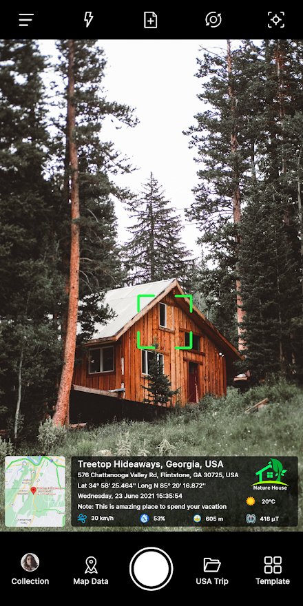
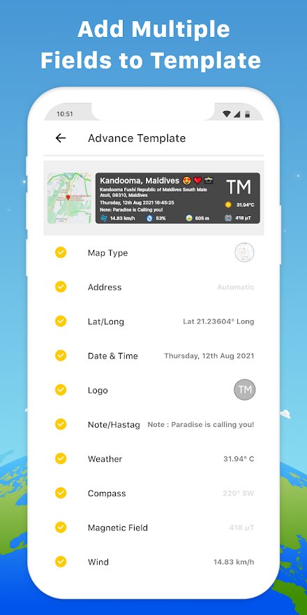
✔ Select Advance or classic Templates, Arrange Formats of Stamps, Change Settings according to Your requirement of GPS map Location Stamp
✔ Add GPS Location stamps automatically to your clicked pictures
Interesting Features:
➤ Get Custom camera with Grid, Ratio, Front & Selfie camera, Flash, Focus, Mirror, Timer, capture sound Support
➤ Set Map data as Automatic or Manual
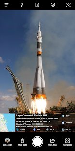
➤ Classic Template contains automatically fetched stamp details
➤ In Advance Template:
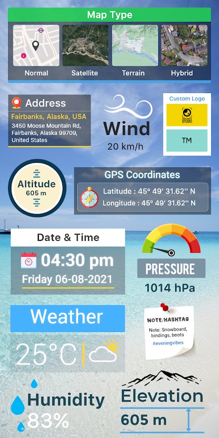
1. Change Map type: Change Map type from Normal, Satellite, Terrain, Hybrid Options
2. Address: Add your selected Manual / Automatic location on the image
3. Lat/Long: Set GPS Coordinates from DMS or Decimal Options for GPS Stamp
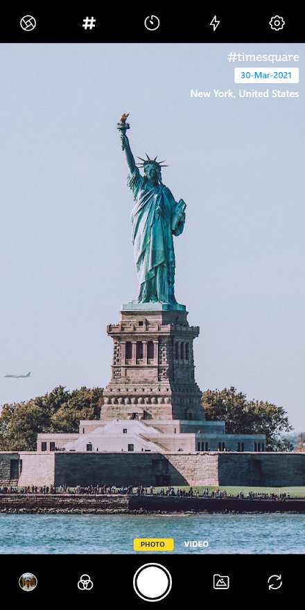
4. Date & Time: Add Date & Timestamp from various formats as an image tag
5. Logo: Upload your brand logo
6. Note: Write relatable Notes
7. Hashtags: You can also add hashtags related to your photos
8. Weather: Either in Fahrenheit or Celsius, Measure Temperature Units
9. Compass: Auto compass direction
10. Magnetic Field: Auto magnetic field Details
11. Wind: Measure Wind speed
12. Humidity: Auto Humidity measurement
13. Pressure: Measure pressure of the place
14. Altitude: It will automatically calculate Altitude
15. Accuracy: Get auto accuracy on image
Why have GPS Map Camera Application in Your Smartphone
➝ To get Satellite Map Stamp on Photos while clicking
➝ For putting GPS Map Location Stamp on photos
➝ Adding Geotag Stamp & date stamp to make focused clicks
➝ Find Photo Location stamp with a geotagging camera at one place
➝ To Add Date Timestamp which performs as both timestamper & date stamper
➝ Works as GPS note camera that easily stamps GPS details on photo
➝ Put Longitude, Latitude, Address, Date-Time, Location stamp to Photos
Utilize as GPS tracker on Photos
➝ To Get Location image stamp with simple camera GPS
➝ Camera timestamp having custom stamps for adding details manually
Most Efficient Application For Following Groups of People:
➥ Travelers & Explorers can effectively utilize Geo-tagging camera
➥ People associated with business related to real estate, Infrastructure, Architecture can easily apply GPS Map Location stamps to their Site Photos
➥ Individuals having Destination celebrations of events like Wedding, Birthdays, Festivals, Anniversaries, etc
➥ Anyone who wants to add GPS Details on their photo as a GPS notecam can have this App.
➥ Persons having outstation Meetings, conferences, Conclaves, Meetups, Events arranged by companies or Institutions solving and serving a particular purpose
➥ Travel, Food, Fashion & Art Bloggers can advance their experiences by adding GPS Location through GPS Map Camera
➥ Place Oriented businesses, where You require to send images with Live Location To Clients
For experimenting with such Interesting Features MUST Download GPS Map Camera: Geotag Photos & Add GPS Location Application Right now on your Smartphone.
Do not forget to share your best experiences with us through Rate & Review.
COLLAPSE
Related Apps
-
AOTD
Stampwallet
by Media599
3557 -
dBee
by Claude Newman
2778 -
AOTD
EaseVPN Proxy - Super VPN Master Free HubVPN 2019
by vivatechsol
3604