PRO CHARTS: Marine Navigation GPS Maps & Noaa Nautical Charts
by MiraTrex

Description
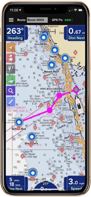
The MiraTrex PRO CHARTS™ is a powerful, yet easy-to-use marine navigation solution. For those who prefers travelling by their own boat, but worried about getting lost in the ocean, Marine Navigation is one of the Best Marine navigation GPS trackers which will let you find your direction in the sea. It Includes High Standard satellite, Road, Hybrid maps, Noaa nautical charts navigational features, and frequent app upgrades.Whether you’re a fisherman, weekend cruiser, sailor, jet-skier, or an offshore captain, if you need to find an exact location hundreds of miles offshore, PRO CHARTS ™ helps you get there safely.
Marine Navigation: Key Features:
- Super easy to use GPS map tracker tool
- Download Maps to use in offline mode
- Available in different languages: English, Arabic, Danish, Dutch, Finnish, French, German, Greek, Hebrew, Italian, Japanese, Korean, Norwegian Bokmål, Norwegian Nynorsk, Polish, Portuguese, Russian, Simplified Chinese, Spanish, Swedish, Traditional Chinese, Turkish
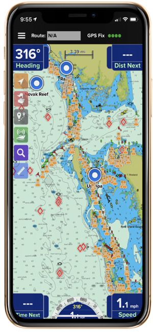
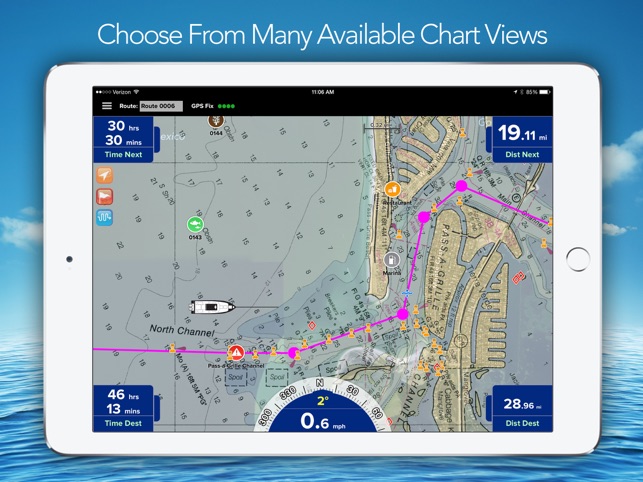
- High-resolution nautical chart coverage for all U.S. navigation coastal areas, the Great Lakes, major U.S. river systems, and Brazil plus global high-level nautical charts. Charts are automatically updated after the 7 days based on NOAA chart corrections.
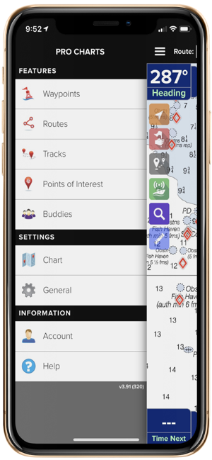
- Easy one-touch Waypoint and Route creation. Pre-plan your routes at home or create it at sea with equal ease. Just touch the screen to create new waypoints and routes.
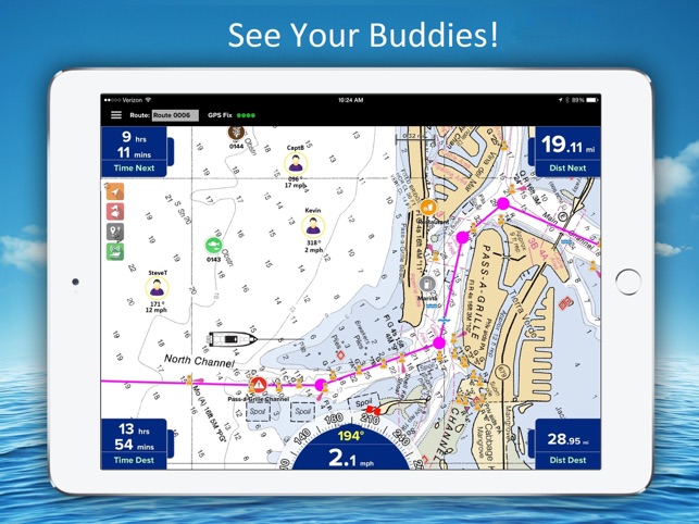
- Find your friends on the water. With our new Buddy-tracking feature, you can find your friends while you’re out on the water. If you’re on your secret spot and don’t want to be seen, you can hide your marine location with the touch of a button.
- Stay safe. Easily create and send a Float Plan of your trip to a friend or family member. Your Float Plan and location history can be forwarded to search and rescue personnel in case of an emergency.
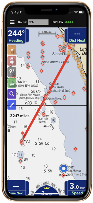
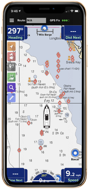
- Easy point-and-steer navigation. The red heading bug on the large on-screen compass always directs you to the next point on your route. Navigation is as easy as pointing your boat at the heading bug to stay on course.
- No Network. No Problem: PRO CHARTS™ is designed in such a way that it will not stop working if you have no internet connection. It will allow you to view your charts Available on offline navigation GPS maps while out on the water.You simply have to download the location charts in advance that you need while travelling and then you can use it with the touch of a button.
- Record your marine navigation tracks. Track your position in real-time and later view your track history.
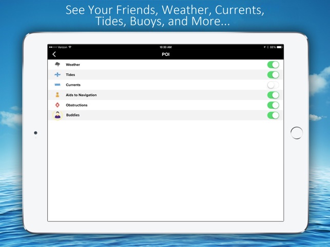
- Fully indexed point of interest (POI) database including weather, aids to navigation (markers and lights), obstructions, tides, currents, your buddies, and more.
Get all the exciting features of PRO CHARTS™ in minimum amount and discover your routes just in $2.99/mo or $29.99/yr.
Download the app now and find your way now with this app.
Website: www.miratrex.com
Related Apps
-
Earthcam HD: Live View From Space, Public Cameras
by Mehran Nadeem
2272 -
EpiCenter App | by AssureTech
by AssureTech
2134 -
AOTD
TempoMaster: GPS Speedometer/Odometer & Car Finder
by Tempomaster
2706